An exhilarating trek in the remote part of Nepal, Tashi Lapcha is arguably one of the most appealing trekking in the whole Everest region that passes through two different Himalayan regions- Rolwaling and Khumbu. Rolwaling has a unique environment and is exceptionally rich in bio diversity, which makes this region one of the finest tourist destinations in Nepal. This invigorating trek offers you magnificent views of the Gauri Shankar and Melungtse. Entire research expeditions have so far unsuccessfully attempted to find him.This leads arduous trek with expedition style camping treks into the Rolwaling Valley. This trek becomes even beguiling when we move ahead to climb Parchamo Peak (6273m). Inhabited by the Tamang people. Rolwaling offers on incredible experience of isolation, mesmerizing mountain views, diverse flora & fauna and extremely mystifying local cultures. Tashi Lapcha Pass is technically a difficult route; one must have good hiking experience and should give proper attention to acclimatization.
Highlights of Rolwaling Everest trek
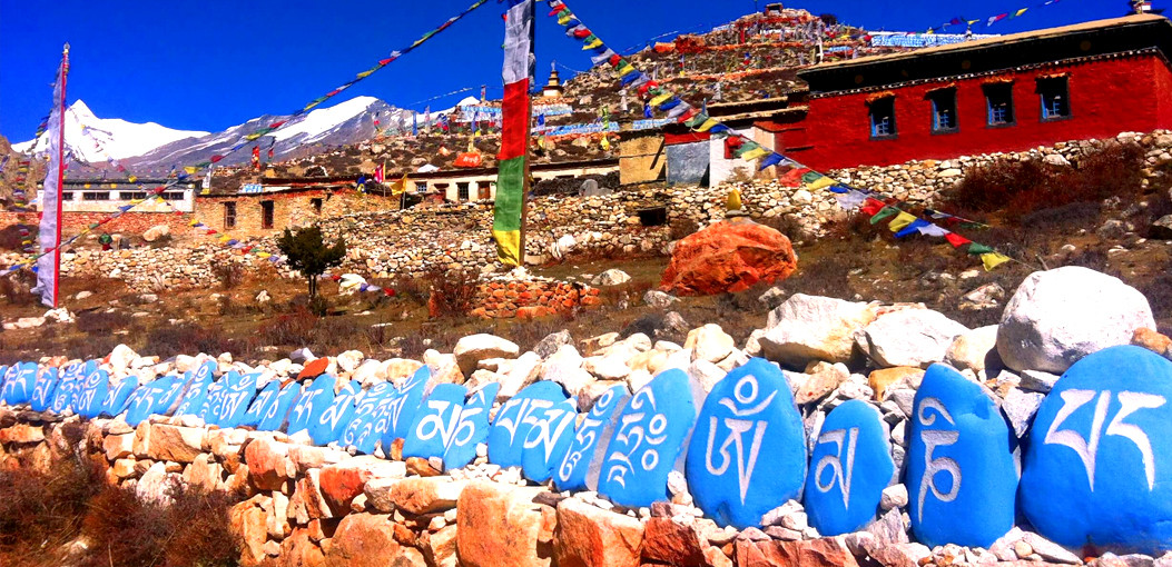
Rolwaling Valley, Gauri Shanker (Holy Mountain), Amodablam, Mt. Everest, Lhotse, Pumori, Glacier Lake (Tso Rolpo) Sherpa culture and custom. Trek one of the highest passes in Nepal and enjoy the Gateway of Everest, Namche Bazar
After breakfast, drive out of the Kathmandu valley on the road to Jiri, built by the Swiss in the 1960's. There are some excellent views of the Jugal Himal peaks, Dorje Lakpa and Phurbu Gyochu as well as Gaurishankar and Menlungtse along the way.
After breakfast, we start with a steep climb behind the town of Borobise through rice and mustard fields. After a couple of hours, we pass through the Brahmin village of SimIe, before arriving at the ridge-top, where we gain a magnificent view back down to the Sun Koshi riven This is o good place to observe birds of prey soaring above the ridge. Continuing upwards we reach Budepa, cross a tributary stream and camp near to Kabre village.
We continue climbing through small settlements and then enter the Rhododendron forest before reaching the extensive village of Dolangsa. There is a small gompa here and in the winter time, the village is famous for making bamboo mats and baskets and also for its knitted woolens.
It's a long haul up to the pass with its superb, close-up views ofBigfera Go and Gouri Shankar and a more distant one of Mount Everest itself We then make a long descent of the wooded east ridge to reach the settlement of Ruptang before continuing down for another three hours to reach Bigu. This is one of Nepal's most remote nunneries and many of the nuns ore Tibetan refugees. Its local name is Tashi Gompa. There are a small guest house and paper-making factory.
We descend to Samling Khola (1710m) observing exotic flora on the way, before our climb to Chilangka, a small village spread above and below the main trail.
The route presents a few ups and downs and there are many small villages and some magnificent views of the Gaurishankar Himal. There is a large school in Worong (Orangdando).
More small and scattered villages on the ridges above the Tambu Koshi river.
We wind our way down the hillside to reach the Tambu Koshi river. Cross the small tributary using the suspension bridge or take the shortcut over the bamboo bridge below. It is at this point that our trail from Barobise meets up with the trail from Dolokha. We cross the Gongar Khola and a few minutes later we reach the village town of Gongar Continuing north, we reach the teashops at Chetchet; the most difficult part of the hike is just across the river. At the last cluster of teahouses, keep on eye out for the trail down to the river and across the suspension bridge. As we climb up the path along the scar of a recent landslide keep a watch for the playful monkeys who frequent the cliff faces along this short stretch of trail. A very steep and sometimes hair-raising scramble brings us to the picturesque village of Simigaon sprawling over a terraced knob (1600-2000m). From the saddle. there are excellent views of Gauri Shankar and the steep valley walls below, Simigaon is a large agricultural village, growing mainly millet and inhabited by Tamangs in the lower part and Sherpas in the upper.
After 15-20 minutes we enter The deep humid forest of the lower Rolwaling Valley and it is in this section that we begin to get a feeding for the true remoteness of the valley. The trail soon begins to descend steeply in three drops of 60-100m, then levels out and reaches a single farmhouse only 75m or so above the river Then, we climb through a series of switchbacks, cross a small bridge and continue on through the forest. 1-1 and half hours after the first ramshackle tea shop. we come to a rather more substantial teahouse. A few minutes later the trail forks, with one branch descending to the left and the other bearing straight ahead. Both trails eventually meet up again later but the upper trail is more traveled and offers a spectacular view of an incredible waterfall Some ten minutes later, we encounter another waterfall. The climb continues, eventually easing into a pleasant traverse with excellent views of the valley below and the mountain above. About 3 and half hours after leaving Simigaon, we reach Kelche, a small cluster of huts with one or two teahouses on a small crest From here, it is only about half an hour down to Drongkhang, a series of three teahouses in a clearing festooned with prayer flags by the river.
The last part of The climb from Drongknang to Beding is filled with breathtaking views and almost no sign of human habitat. After Drongkhang, the mixed forest is not so dense; in fact, it was pretty much cleared by a forest fire a few decades ago, and most of what you see at first is newer growth begins with a short climb, but is, on the whole, a gentle and pleasant ramble close to the river -- except for one 10-minute climb straight up to a new bridge, and then straight down again. Continuing through rhododendron forests and mossy boulders, we reach a suspension bridge across the Rolwaling Chhu about one hour after leaving Dronkhang. The vegetation on the other side of the river opens up and is much drier due to the southern exposure. Great views and towering cliff faces surround us. The impressive peak on the north (left) side of the valley is called Tabayabum . The trail levels off slightly after near about an hour offering superb views of Chekigo.Another 30-45 minutes brings the trail back alongside a temporarily calm stretch of the Rolwaling CHhu and a fork in the trail. The trail coming in from the left and across the log bridge is the high route over the Daldung La that used when the regular trail is impassable during the monsoon. The prayer flags and katas in the trees and surrounding area mark theSamtor Goro, a site sacred to many Hindus as well as Buddhists. According to local myth, this locale was revealed as the dwelling place of Chi Gora (Nai Devi) when a yak was found to be spilling milk at the spot every night Twice each year, the Sherpas make offerings of milk at the small shrine. Lowland Hindus make the trek each November to present their offerings.
The trail to Beding continues straight ahead. In a half hour, perhaps a bit more, we come to the first of the winter settlements, called Nyimare, which is marked by a row of mani stones, Beding is now only X-1hrs away. Before reaching Beding, the trail passes the other winter settlements of Romding, Gyabrug, and Chameka. These villages are named for their physical attributes. Nyimare means ''good sun'' or "early sun," Gyabrug means "late but warm sun," Ramding refers to the avalanche-prone waterfall across the river, and Nyimare means "wolf no" referring to the trees that were cut to destroy the habitat of livestock killing Jackals, There is a teahouse on the hill just above the great tree right after the bridge over Jomo'i Gul Chhu,
Visit the small Gompa situated at the edge of town. The thankas inside the Gompa were painted in 1960 by the famous artist. Kappa Kalden from Khumbu. Although the external displays near the entrance are in poor condition, the interior paintings have been well preserved. The northern wall of the Gompo is filled with the books of the Kongul and Yum, which were carried from Tibet after being printed in 1944. If we are lucky, we may be able to witness one of the numerous festivals that take place at the gompa each month. Two new gates were built in 2001 which frame each side of the courtyard and enclose the gompa compound. The lamas request that pictures are not taken inside. As with all of Nepal's gompas, donations are expected.Another great walk is to Chamgang retreat (45 minutes up from Beding) for a spectacular view. Perched on the cliffs above Beding, Chamgang is a small meditation retreat presumably intended for one monk. The building was constructed and financed by Lama Nawang Tembi, with help from local villagers. The path up to the retreat is ambiguous, particularly in the lower reaches.
Start above the gompo and head toward the yellow prayer flag. The path skirts the left side of the major rock buttress before crossing below the flag and continuing along the wide ledge to the small white building. From here there are excellent views up and down the valley. The three major mountains that make up the southern valley wall ore all over 5,500 meters. From east to west (left to right), they ore Yalung Ri, Dorje Phogmo and Tobayabyum. If the weather is clear, the late evening offers impressive displays of alpenglow on these craggy peaks.Also in close proximity to Beding are several photogenic waterfalls. One can be reached by o short walk to the upper (east) end of the village and following the stream that powers the little watermill Another impressive cascade cuts into the rock above the suspension bridge at Chameka (Nyimare), 20 minutes west of Beding. We can scramble up to the cirque above the falls by staying close to the eastern edge of the steep valley and finding a little-used path. The stream which originates on the southeast face of Gauri Shankar and plunges through the rifted escarpment is known as Jomo'i Gul Chhu: "the Lady's Piss Stream"-- the Lady in question being Jomo Tseringma, oka Gauri Shankar. On a clear day, this hike offers views directly up the steep ice and rock walls that form the Tibetan border. From some vantage points, it is also possible to stare up the imposing southeastern flanks of Lady Tseringma,
Another possible hike from Beding is toward the Menlung La, The trail breaks left of the main trail several hundred meters up the valley from Beding, The steep climb gains a lot of altitudes, making acclimatization important. This hike brings us to the Glacier below the Menlung La, It was over this high pass that Rolwaling locals traditionally carried out their trade with Tibet before the Chinese closed the borders in 1959. They would trade yaks, salt, wool, rice, and other goods between Tibet and India. This is also the sight where Eric Shipton spotted the Yeti in 1951 and took his famous photograph^ His was the first western sighting of the elusive creature and sparked the hype surrounding its controversial existence that continues to this day. The border is still officially off limits to tourists, and it is possible that even a trip close to the pass could be considered illegal.
One and a half hours up the valley from Beding is the last major settlement, called No. This village is the oldest in Rolwaling and was the main settlement before agriculture shifted its focus from barley to potatoes. Once the potatoes were introduced, cultivation became possible at lower altitudes and the Sherpas built Beding and the winter settlements. Its fields, lined by several kilometers of rock walls, still produce the majority of the valley's crops. The volley's first Gompa was originally built in Na. High up on the hillside at the western end of town is the No meditation place, visible by its numerous prayer flags. The large rock under which the retreat is built is known as Urgen Drokang, thought to be a spontaneously created likeness of Guru Urgen Rinpoche. Below the meditation place, painted on a large flat rock, is a picture of Guru Urgen Rinpoche. And below this painting is several large mani stones which were also visited by Rinpoche on his way through the valley and into Tibet The large square stone is known as Urgen Shuti and is believed to be the chair of Rinpoche during his stay in the valley.
The giant glacial lake of Tsho Rolpa has received a great deal of press in recent years. Fear that this lake may breach its natural dam and flood the valley below has lead to a much international intervention. While previous attempts to siphon the water from the lake have failed, a current program which employs a series of deep trenches cut into the terminal moraine, has lowered the water level slightly. Still, the danger for an outburst exists. The buildings and signs at the edge of the lake detail some of this information. From Na, the trail to Tsho Rolpa breaks right after the second bridge and follows the well-worn trail to the lake
Follow the Tamur Koshi river southwards to reach Jugot in about 5 hours.
Your safety is of paramount concern whilst traveling with Himalayan Trailfinder. Please note that your leader has the authority to amend or cancel any part of the itinerary if it is deemed necessary due to safety concerns. Every effort will be made to keep to the above itinerary; However, as this is adventure travel in remote mountain regions, we cannot guarantee it! Weather conditions, health condition of a member, unexpected natural disasters etc, can all contribute to changes in the itinerary. The leader will try to ensure that the trip runs according to plan, but please be prepared to be flexible if required.
Tims card and national park entry permit.
Experienced guide and porter one for two guests.
All ground transportation during the trip.
Three meals a day (Breakfast/Lunch/Dinner) and accommodation in local family house/lodge.
Emergency rescue arrangement.
First aid kit.
Water resistant kit bag.
Walking poles.
High quality Italian camping equipment (Ferino, La Sportiva, Salewa).
Down sleeping bag, Down jacket air mat on request.
Drinks, beverage water
Donations, tips
Personal expenses
Visa fee on arrival